About service
Empowering organizations with the right geospatial insights and technology
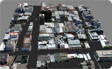
We empower organizations with precise geospatial data, cutting-edge tools, and expert analysis to make smarter decisions. By combining advanced aerial surveys, 3D modeling, and spatial analytics, we support your growth, enhance operational efficiency, and enable proactive planning for a sustainable future.

Our services
How we help you make smarter decisions
Our comprehensive geospatial services are designed to support industries in achieving their goals through data-driven insights and innovative solutions.


20+
Projects Delivered
10+
International Clients
24/7
Online support
10+
Years Combined Experience
Our features
Our expertise drives your success
Our team combines technical excellence with a deep understanding of geospatial science, helping you achieve operational efficiency, strategic growth, and environmental sustainability.